As a powerful winter storm looms over the United States, the implications of this meteorological event call for comprehensive exploration. With millions of Americans preparing for one of the harshest winter conditions in years, various states have declared emergencies, highlighting the scale and potential impact of this storm. This article delves into the origins, scope, and consequences of the impending harsh weather, as projected by national weather services.
At the center of this winter storm is the polar vortex, a significant player in the narratives surrounding extreme cold fronts. Defined as a substantial area of low pressure circumscribed by cold air that typically remains over the polar regions, the polar vortex can deviate—sometimes dramatically—leading to surges of frigid air descending into lower latitudes. These events underscore the dynamic nature of weather patterns that influence the climate across vast regions of North America.
In this instance, the polar vortex has dislodged, spilling icy air southward, which has already begun to blanket parts of the Midwest. This occurrence is not merely an anomaly; historically, similar disruptions have led to record low temperatures and significant snowfall events. Understanding this background enriches our comprehension of current weather forecasts and the warnings issued by weather authorities.
Impacting an estimated 60 million people, the sprawling nature of this storm stretches across 30 states, from the heart of the Plains to the mid-Atlantic region. As the storm embarks on its eastward journey, states such as Kansas, Arkansas, Kentucky, and Virginia are on high alert. The National Weather Service (NWS) has issued a range of alerts from blizzard conditions to severe cold warnings that will disrupt daily life and travel.
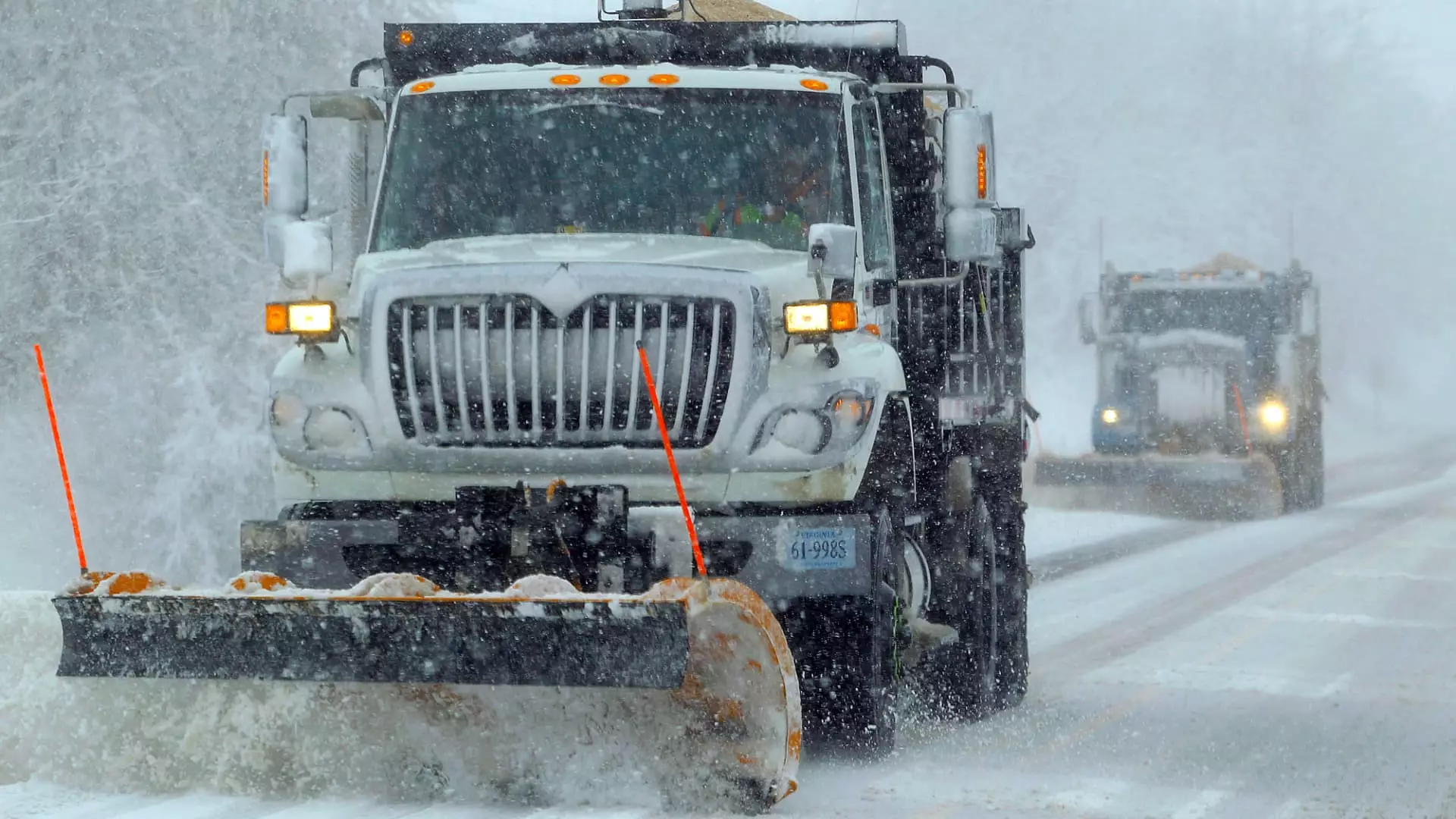
Notably, Kansas City’s International Airport experienced operational challenges with significant flight delays due to the weather conditions, illustrating the storm’s immediate effects. Interstate highways have also been compromised; the closure of an 18-mile segment of Interstate 70 highlights the hazardous driving conditions that accompany heavy snow and high winds, which may reach gusts of 40 mph. Weather forecasting predicts that some areas in northeastern Kansas could see more than 15 inches of snow, marking this event as one of the harshest in a decade.
Blizzard warnings serve as critical indicators of the impending dangers faced by residents in the storm’s path. These warnings signal not just the potential for perilous driving conditions but also significant visibility challenges due to heavy snowfall and wind. The NWS has unequivocally warned of “considerable disruptions to daily life,” as many families brace for power outages and transportation limitations.
Cities like Cincinnati, Chicago, and St. Louis are proactively treating roads in anticipation of dangerous weather. They have also set up warming centers to protect those who may find themselves without adequate heating. This community-oriented approach emphasizes the importance of preparedness in the face of severe weather threats.
The travel disruptions extend not only to roadways but also to air travel, with nearly 7,000 flight delays reported nationwide. The cumulative effects of the storm are felt disproportionally in states unaccustomed to such severe conditions, which raises concerns for travelers and local residents alike. Major airlines are responding by waiving change fees for affected passengers, indicating the widespread disruption caused by the storm system.
As the storm marches eastward, municipalities from Washington D.C. to Philadelphia brace for snow and ice, expecting accumulations that could range from several inches to over a foot. Southern states, which typically enjoy milder winter weather, are also on alert for severe thunderstorms, drawing attention to the storm’s unpredictable nature and its extensive reach.
Ultimately, the arrival of this winter storm signals not just a shift in weather but also a reminder of nature’s power. As minimum temperatures plunge drastically in the ensuing days, with forecasts projecting highs 10 to 25 degrees below average, residents must equip themselves to withstand the cold. In the northern Plains, the chilling forecast of overnight lows nearing -20 degrees Fahrenheit, coupled with wind chills around -40, reinforces the seriousness of the weather advisory issued across multiple states.
As communities respond to these challenging conditions, the need for vigilance and preparation becomes paramount. The impact of this storm stands as a reminder of the importance of staying informed and ready to adapt in the face of an increasingly volatile climate. The resilience of American communities will be tested in the days to come as they navigate this historic winter storm.